Eryri National Park covers an area of 213,400 hectares, has a boundary of 362.29km and a coastline that extends for 60km. It incorporates large areas of woodland (both deciduous and non-deciduous), and over 96,000 ha of moorland.
The unique and varied landscape of Eryri is of exceptional quality and as such is one of its greatest assets forming a primary reason for its designation as a national park. Eryri National Park is recognised by the character and quality of the landscape, which is valued for its natural beauty, distinctive biodiversity, diverse geological resources, cultural heritage, rural character and unspoilt tranquillity.
The landscape within the National Park has been shaped by millions of years of natural evolution through mountain building and the erosive effects of glaciation, wind and rain. But human activity is also a significant influence through thousands of years of land management practices which have resulted in close socio-cultural associations being created between man and the landscape. The traditional rural character of settlements is distinct to the National Park and forms part of its historic landscape character. Both the landscape and townscape therefore play a fundamental role in the tourism industry, and therefore the local economy.
The Eryri Landscape Character Assessment
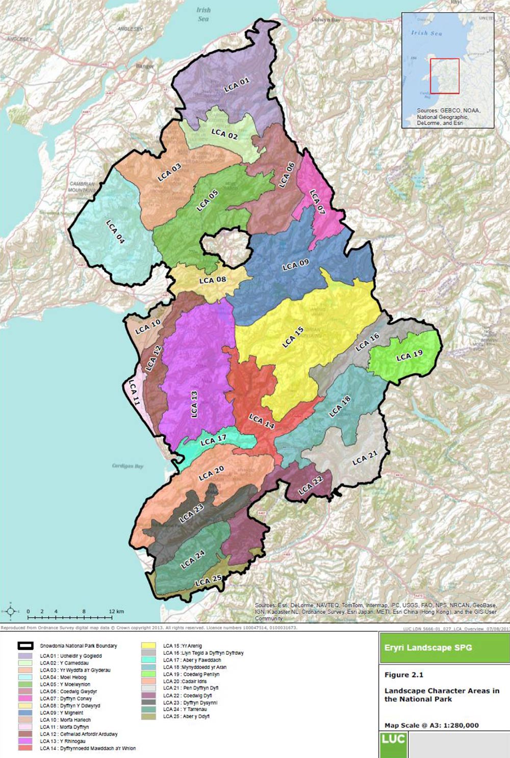
Since the last State of the Park Review the SNPA commissioned consultants to undertake an assessment of Eryri’s landscape and to identify coherent Character Areas. The resulting Landscape Character Assessment drew on LANDMAP11 as part of its evidence base, along with a wide range of other information that described the natural, cultural and aesthetic/perceptual qualities of the National Park.
Following a desk-based assessment – which included a review of the LANDMAP information and other spatial data –a field verification exercise was undertaken to confirm the boundaries and information provided for the 25 Landscape Character Areas (LCAs) identified. The LCAs are designed to represent geographically discrete areas of the National Park’s landscape that are recognised for their local distinctiveness and sense of place. They will form a useful spatial framework to describe the landscape and to ultimately assist in making decisions on how it should be planned and managed to maintain or enhance its special qualities.
The layout of the Assessment is structured with each LCA described separately, as follows:
- Summary of LCA location and boundaries, including a map and representative photographs;
- Key characteristics;
- Forces for change affecting landscape character;
- A landscape strategy for the future;
- Guidelines for managing future landscape change.
The Landscape Character Assessment document can be found in the following link, which takes you to the SNPA’s Supplementary Planning Guidance (SPG) notes page. It is listed as SPG 7.
Supplementary Planning Guidance
Map of the National Park’s LCAs
In the future the framework provided by the LCAs could serve as the basis for monitoring landscape change in more detail. A further refinement of this work is the Landscape Sensitivity and Capacity Assessment.
11 LANDMAP is an all Wales geographic information system based landscape resource where landscape characteristics, qualities and influences on the landscape are recorded and evaluated into a nationally consistent dataset. It is comprised of five ‘Evaluated Aspects’; Geological Landscape, Landscape Habitats, Visual and Sensory, Historic Landscape and the Cultural Landscape.
Eryri National Park Seascape Assessment
In parallel with the development of the Landscape Character Assessment the SNPA also collaborated in a joint project with Anglesey County Council and Natural Resources Wales to produce a Seascape Character Assessment. Seascape Character Assessment is a development of the well-established process of landscape character assessment. It divides the study area into Seascape Character Areas (SCAs); geographically-distinct areas with a unique sense of place, and comprised of different combinations of Seascape Character Types (SCT), which define types of environment through uniform or predominant character as opposed to geographical coverage
The Seascape Character Assessment is structured somewhat differently to the Landscape Character assessment. Profiles are provided for each of the SCAs (which are named by their geographical position) describing the following:
- Location and context;
- Summary description;
- Constituent SCTs;
- Key characteristics;
- Cultural benefits and services;
- Natural influences and sites; cultural influences and sites;
- Perceptual qualities;
- Forces for change and;
- Inherent sensitivity.
The Eryri National Park Seascape Assessment can be found in the following link, which takes you to the SNPA’s Supplementary Planning Guidance (SPG) notes page. It is contained within SPG 7.
Landscape Sensitivity and Capacity Assessment
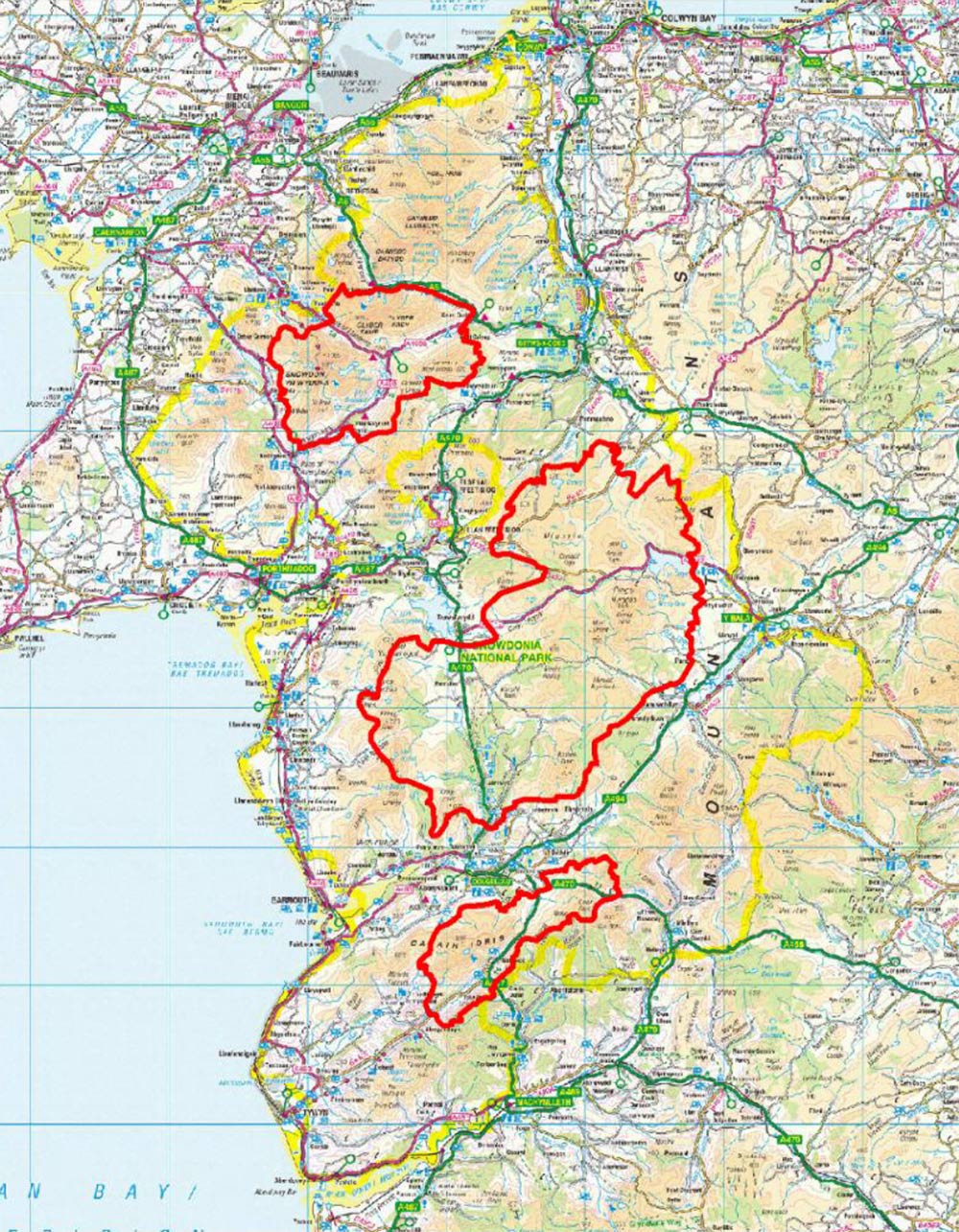
This study was commissioned by Gwynedd Council, the Isle of Anglesey County Council and the Snowdonia National Park Authority It was intended to provide a robust evidence base for determining planning applications, informing the development of Supplementary Planning Guidance, helping to protect sensitive and distinctive landscapes from inappropriate development and encouraging a positive approach to development in the right location and at an appropriate scale. The study specifically considered the following five development types as well as also briefly touching on hydro energy developments.
- Wind Energy (focussing on smaller scale developments)
- Field-Scale Solar PV Energy (not considered in SNPA)
- A 400 kV Overhead Line (Electricity Transmission Infrastructure)(not considered in SNPA)
- Mobile Masts (Telecommunications Infrastructure)
- Static Caravan/Chalet Parks and Extensions (Tourism)
The acceptability of large scale development in the rural landscape is an emotive subject and one where compromise is often needed. Whilst it is generally acknowledged that the most valued landscapes should be protected, there are some areas where development can be accommodated, albeit in a controlled way to minimise adverse effects. This study aimed to understand where and how best to accommodate the different types of development identified in the brief.
It is important to note that this is a strategic study and is not prescriptive at an individual site level. It does not replace the need for assessment of individual planning applications or for specific local landscape and visual impact assessment as part of formal Environmental Impact Assessment (EIA). The assessment does not take account of other natural and cultural heritage considerations (except where they relate to landscape character and visual considerations), technical factors or the perceived need for the development.
The Landscape Sensitivity and Capacity Assessment can be found in the following link, which takes you to the SNPA’s Supplementary Planning Guidance (SPG) notes page. It’s listed as SPG 13:
Tranquil Areas and Dark Skies
Within the National Park tranquil areas are determined using a multi-criteria approach, having to lie at least:
- 4km from the largest power stations
- 2km from major trunk roads and the edge of towns
- 1km from medium disturbance roads and some mainline railways, areas of active quarrying, military and civil airfields, low disturbance roads, 400kv and 275kv power lines
The Tranquil Areas Map (see Figure 7) has been generated taking into consideration the general impact of noise on the environment and the impact of noise and light pollution from built up areas.
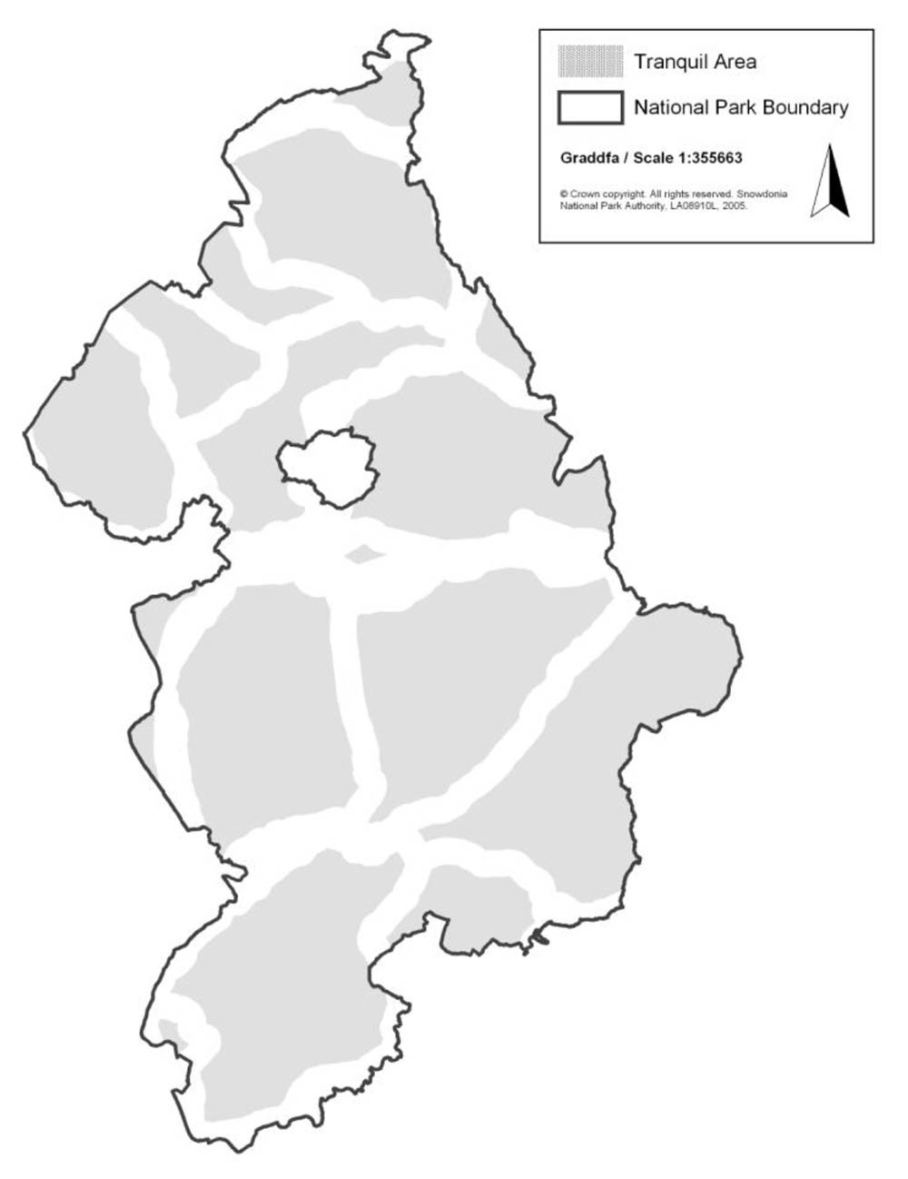
Extent of tranquil areas in the national park: 143,692ha
Percentage of the national park categorised as tranquil: 67%
Eryri Dark Skies Reserve
A Dark Skies Reserve designation is a prestigious award given by the International Dark Sky Association (IDA) to select destinations that have proven that the quality of their night sky is outstanding and real efforts are being made to reduce light pollution. The National Park Authority applied to the IDA for Dark Skies Reserve status in the summer of 2015. This followed months of survey work by volunteers who went out to measure the quality of the night skies of Eryri.
By gaining Reserve status in October 2015 Eryri will be able to take advantage of other benefits resulting from the designation. In other areas that have been designated, such as the Brecon Beacons and Galloway in Scotland, the environment, economy, welfare, tourism and wildlife have benefited, which in turn, has contributed to reducing the carbon footprint as less electricity and fossil fuels are used.
As result of Dark Sky Reserve designation it is envisaged that:
- the area’s wildlife will benefit;
- the quality of the area’s environment will be enhanced;
- Eryri will have an additional natural feature to attract new visitors to the area at quieter periods of the year;
- it will provide a boost to the local economy and
- Eryri’s dark skies of will be protected for future generations.